Difference between revisions of "Tamaki River Narrows Sites - Visit"
(→Concrete Road 1931) |
|||
| Line 53: | Line 53: | ||
===Concrete Road 1931=== | ===Concrete Road 1931=== | ||
{| | {| | ||
| − | |In the late 1920s and early 30s a series of concrete surfaced roads were built across Auckland from Titirangi to Howick subsidised by the National Roads Board. It took rare co-ordination by Auckland's many local authorities to achieve this. The Panmure sections linked to the second Tamaki bridge. The roads mostly still exist but typically are now surfaced with asphalt and their ongong contribution unappreciated. The section of road in Kerswill Place is a rare visible exception ending at | + | |In the late 1920s and early 30s a series of concrete surfaced roads were built across Auckland from Titirangi to Howick subsidised by the National Roads Board. It took rare co-ordination by Auckland's many local authorities to achieve this. The Panmure sections linked to the second Tamaki bridge. The roads mostly still exist but typically are now surfaced with asphalt and their ongong contribution unappreciated. The section of road in Kerswill Place is a rare and visible exception, formerly ending at the second bridge, but now just a suburban street. The new concrete road to Howick was opened in 1931. [http://paperspast.natlib.govt.nz/cgi-bin/paperspast?a=d&cl=search&d=AS19310124.2.90&srpos=7&e=--1919---1945--10-AS-1----0concrete+road+howick-- Papers Past] |
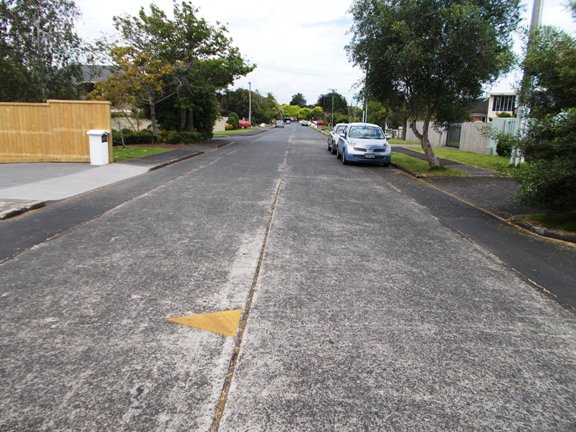
|[[File:Concroad.jpg|framed|The concrete road in Kerswill Place.]] | |[[File:Concroad.jpg|framed|The concrete road in Kerswill Place.]] | ||
|- | |- | ||
Revision as of 15:10, 17 November 2013
Contents
Tamaki River Narrows Sites
| SITE TO VISIT | |
|---|---|
| Tamaki River Narrows Sites | |
| - | |
| | |
| | |
| Ethnicity: | European |
| Site type: | Bridges and maritime features |
| Where: | East side of the Tamaki River at Panmure |
| How to get there: | Park in Kerswill Place - use the Rotary walkway. |
| How Long to allow: | 45 minutes. |
| Disclaimer | |
Location:
What:
An assemblage of related sites concentrating on the narrowest section of the Tamaki River - a tidal channel on Auckland's eastern side. The narrow section of the river made is attractive as a site for bridges - there is still one here today, and the proximity of deeper water to the shore for more modern landing facilities. Nearby today there are still slipways and boat construction yards. There are interpretive signs along the Rotary Walkway.
First Bridge 1865
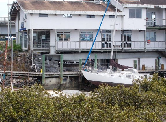
| This early piece of Auckland engineering replaced a ferry. The first bridge here survives in part - and was recently restored. It is a swinging section sitting on a turntable with a geared turning mechanism. The turntable can be seen on the bluestone abutment top the left of the bow of the yacht. The swinging section of the bridge now supports the building that detracts from the site. |
Second Bridge 1916
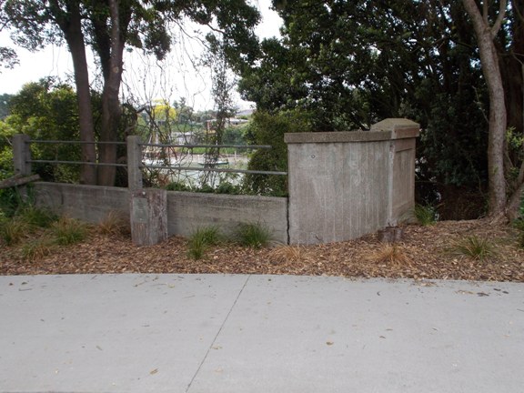
| The second bridge replaced the first. It was early reinforced concrete but poorly built and quickly became a concern for its safety. It was demolished in 1963 after the third and existing bridge was built. All that remains are these abutment wing walls. |
Concrete Road 1931
| In the late 1920s and early 30s a series of concrete surfaced roads were built across Auckland from Titirangi to Howick subsidised by the National Roads Board. It took rare co-ordination by Auckland's many local authorities to achieve this. The Panmure sections linked to the second Tamaki bridge. The roads mostly still exist but typically are now surfaced with asphalt and their ongong contribution unappreciated. The section of road in Kerswill Place is a rare and visible exception, formerly ending at the second bridge, but now just a suburban street. The new concrete road to Howick was opened in 1931. Papers Past |
Landing Places
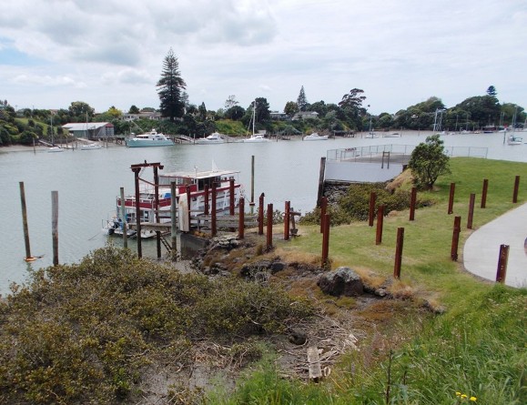
| In the foreground is a landing ramp and cattle yard once used to barge cattle to and from Great Barrier Island by the Subritzky Shipping Company. In the background a landing jetty built by the American forces in WW2 to move goods to and from adjacent storage facilities. |
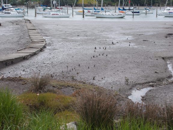
Fish Trap Stakes?
| Stakes - (or are they mangrove roots?) - perhaps the remains of a Maori fish trap. |
Web Info:
The first bridge has an IPENZ heritage register listing - http://www.ipenz.org.nz/heritage/itemdetail.cfm?itemid=2336
