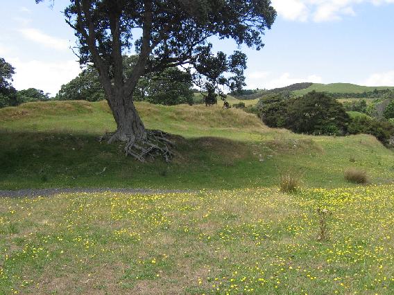
Tapapakanga Pa
| SITE TO VISIT
|
| Pa at Tapapakanga Pa
|
| -
|

|

|
| Ethnicity:
|
Maori
|
| Site type:
|
Fortification
|
| Where:
|
Tapapakanga Park, Firth of Thames
|
| How to get there:
|
Stop at the main carpark, go down to the beach and turn right on to the coastal track, a couple of hundred meteres along there is a branch up the hill to the right which leads directly to the pa.Drive along the Rangikapiti Point road. There is an obvious walking track up to the pa.
|
| How Long to allow:
|
An hour
|
| Disclaimer
|
Location:
Loading map...
{"minzoom":false,"maxzoom":false,"mappingservice":"leaflet","width":"600px","height":"400px","centre":false,"title":"","label":"","icon":"","visitedicon":"","lines":[],"polygons":[],"circles":[],"rectangles":[],"wmsoverlay":false,"copycoords":false,"static":false,"zoom":10,"defzoom":14,"layers":["OpenStreetMap"],"overlaylayers":[],"resizable":false,"enablefullscreen":false,"scrollwheelzoom":true,"markercluster":false,"clustermaxzoom":20,"clusterzoomonclick":true,"clustermaxradius":80,"clusterspiderfy":true,"locations":[{"text":"\u003Cb\u003E\u003Cdiv class=\"mw-parser-output\"\u003E\u003Cpre\u003EPa at Tapapakanga\n\u003C/pre\u003E\u003C/div\u003E\u003C/b\u003E\u003Chr /\u003E\u003Cdiv class=\"mw-parser-output\"\u003E\u003C/div\u003E","title":"Pa at Tapapakanga\n","link":"","lat":-36.97590100000000035151970223523676395416259765625,"lon":175.258476999999999179635779000818729400634765625,"icon":""}],"imageoverlays":null}

The pa
What:
Maori fortification - pa, framed in glorious old pohutukawa trees.
Web Info:
http://www.arc.govt.nz/albany/main/parks/our-parks/parks-in-the-region/tapapakanga/
http://www.jps.auckland.ac.nz/document//Volume_33_1924/Volume_33,_No._130/%26%2334;Kahu-mau-roa_and_Te_Kotuiti%26%2334;,_by_George_Graham,_p_130-135/p1
Photosynth:
Photosynth taken 9 January 2011.
What else to do there:
Visit the Ashby colonial house by the car park. There is a heritage trail at the park that takes in more sites.

